154 East Main Street, Port Jervis NY 12771
Ph: 845-856-3312
Map & Directions
The passing of a loved one may often lead to a long road home. Whether you're coming from near or far, we've made finding us as simple as possible.
![]()
154 East Main Street
Port Jervis, New York 12771
Phone: 845-856-3312
Fax: 845-856-3430
Email: kafhmichael@gmail.com
Directions
From I-84 Heading East:
Take the Port Jervis / Sussex exit. This is New York Exit #1. Take the service road to the light and turn right. Go under the overpass and drive to light. Bear left, following sign “City of Port Jervis.” This is East Main Street. See Below ***
From I-84 Heading West:
Take the Port Jervis / Sussex exit. This is New York Exit 1. Take the service road to the stop sign and turn left. Drive to light. Bear right, following sign “City of Port Jervis.” This is East Main Street. See Below ***
From New York City
Take either the Major Deegan (North) or G.W. Bridge onto Palisades Parkway North to the New York State Thruway (North) to Exit #16 (Harriman) same exit for Woodbury Commons. Go Through the Toll Booth and Straight onto Route 17 West (Soon to Be Route 86) to Exit #123 (For Route 17m & 6 West-signs for Port Jervis). At exit #123 you will go under a small tunnel and merge onto Route 17 m & 6 West. Follow 17 m West for approximately 6 miles to Interstate 84 West (See signs for Port Jervis). Go approximately 16 miles West on I-84 to Exit #1 (Last exit before Pennsylvania). At end of exit ramp take a left at stop sign. Go about 100 yards to traffic light and bear right onto East Main Street.
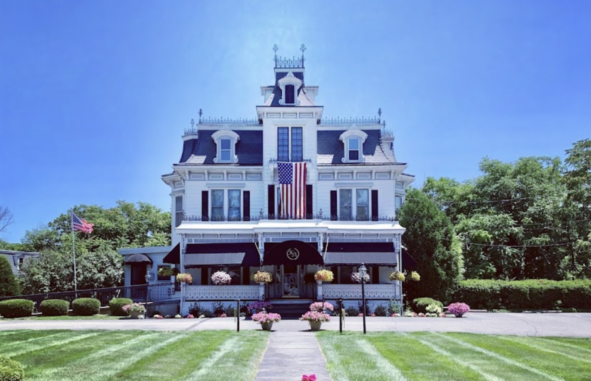
Bon Secours Community Hospital on Right. Knight-Auchmoody Funeral Home is next to hospital. on right.
From New Jersey
New Jersey Turnpike North (about 2 Exits)Onto Interstate 280 WEST, Follow 280 West to Interstate 80 West to Exit 34 for (Route 15 north). Follow 15 North approx. 15 miles thru LaFayette, NJ. Then go Approx. 3 miles (will pass a large nursery on Right) to a traffic light and Rte. 15 ends. Go straight ahead onto Route 206 North until you get into Montague, NJ. When you come into Montague, NJ you will see a Mobil Gas Station on Left and go another ∏ mile and you will see a school on the Right. Just past the school you come to a Y in the Road with a house sitting in the middle of the road. Turn Right at the Y Onto Clove Road which is also (County Route 653) towards Port Jervis. You will also see Blue H (Hospital) Signs. Go 7 Miles on Clove Road (County Route 653) to a Stop Sign at the intersection of Route 23. Turn Left onto Route 23 North go ≤ mile to Traffic Light and Turn Left onto East Main Street in Port Jervis. Bon Secours Community Hospital on Right. Knight-Auchmoody Funeral Home is next to hospital, on right.
*** Follow East Main Street until you see Saint Mary’s Cemetery on your right. At this point you will see Bon Secours Community Hospital. The Funeral Home is the first building past the Hospital.
Knight-Auchmoody Funeral Home
154 E Main St
Port Jervis NY 12771
Michael C. Horkan, Owner / Funeral Director
845-856-3312